

31st January 2021
Very few places on the canal have changed as much as the area which is now Staveley Town Basin. Apart from the basin itself, the Loop Road has been built, the old mineral line has been mothballed and the tracks taken up and there are new bridges at Hall Lane and Eckington Road.
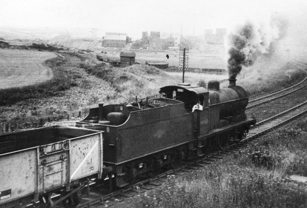
The first seven photos were all taken from Eckington Road Bridge looking west. This was in the 1950s. The canal is completely full of vegetation. The basin site is beyond the small building in the centre.
Photo courtesy Barrow Hill Roundhouse
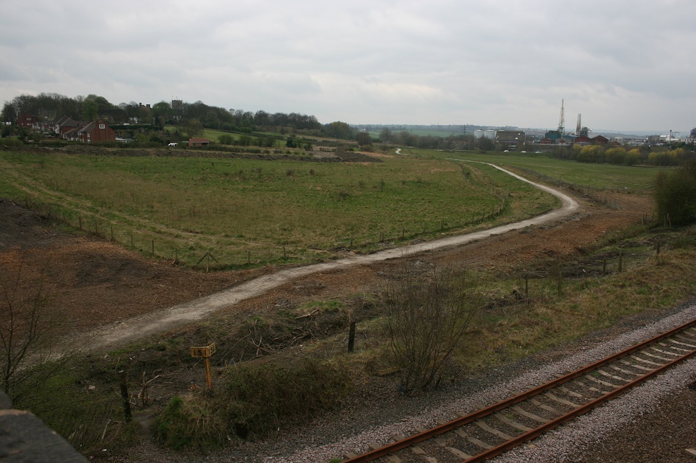
This was the same view in 2007. Photo © John Lower
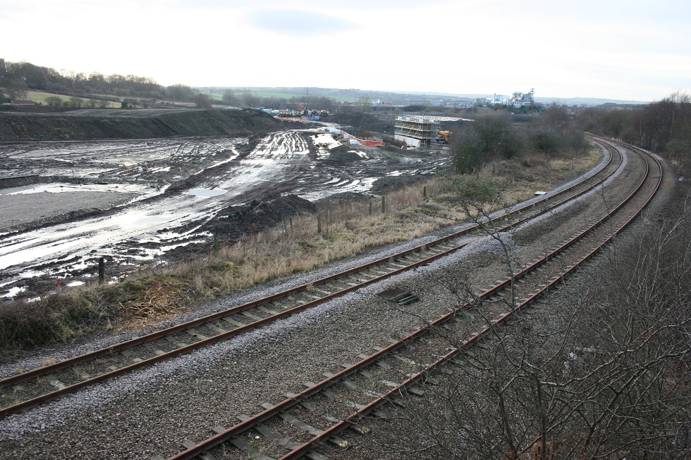
This was 2008 when work on the Loop Road had started. Photo © John Lower
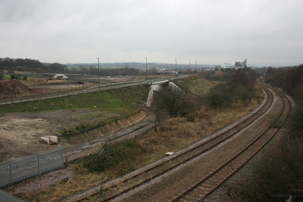
This was in 2010, when the Loop Road was open, but work had not started on the basin beyond it.
Photo © John Lower
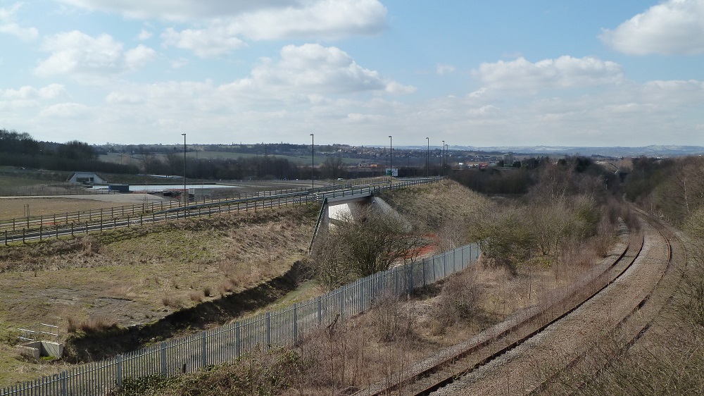
This was 2013 when the basin was complete.
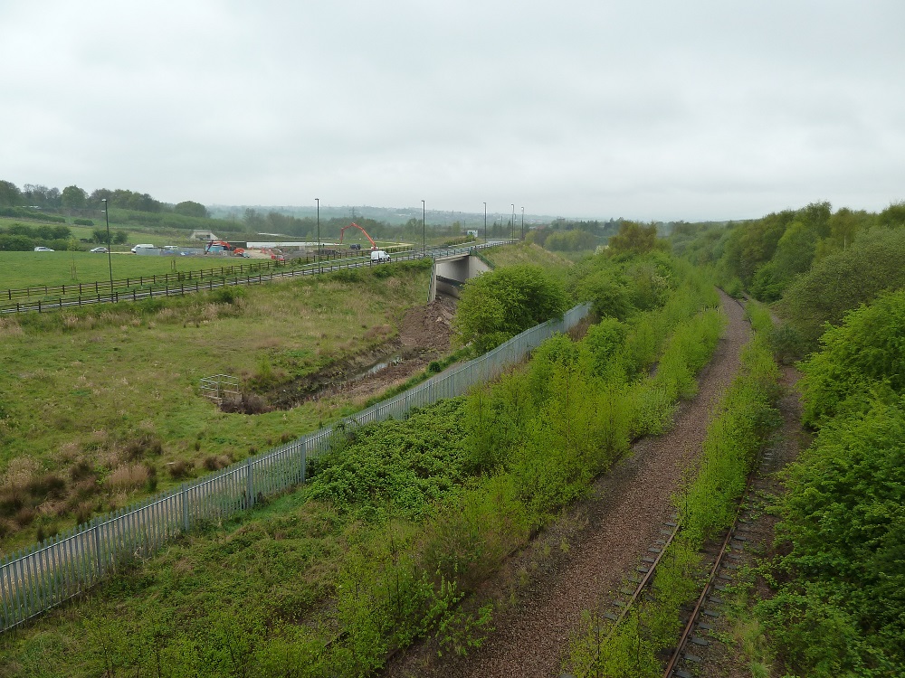
This was 2014. There was a concrete pour at the lock and the railway track was rapidly being overgrown.
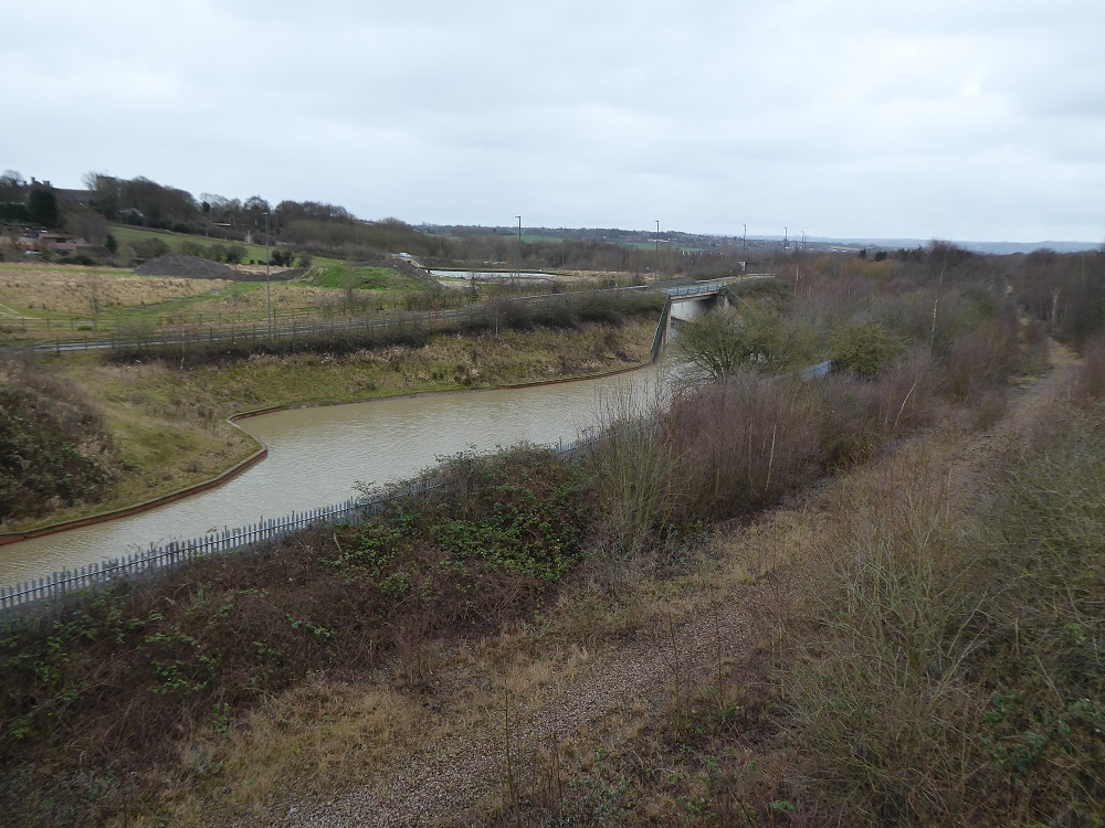
This was taken on 30th January 2021. The railway track had been taken up.
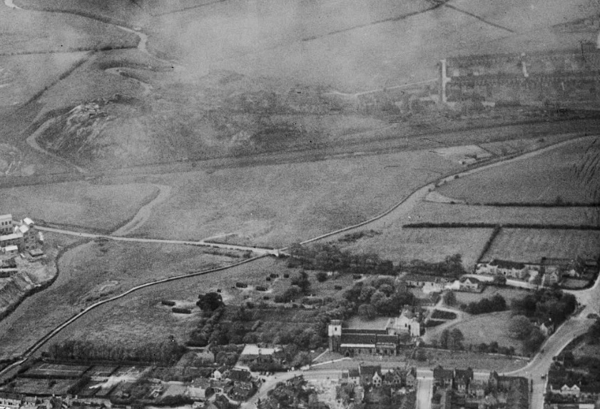
This is an aerial photo from 1947. Staveley Church is in the foreground, the river Rother on the left, Hall Lane is running horizontally through the centre, the canal runs diagonally with the site of the basin at the top right. Eckington Road is just out of shot.
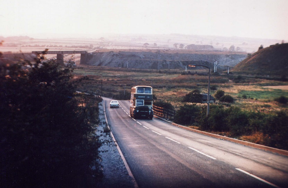
This shows Hall Lane in the 1950s. The bus is crossing the old canal bridge. The basin site is on the right. Photo courtesy Dave Robinson

This is an aerial view from the 1990s. Hall Lane is running diagonally from bottom left to top right. The old Eckington Road Bridge is top left. The site of the basin is to the left of the chimney. Photo courtesy Rhodia
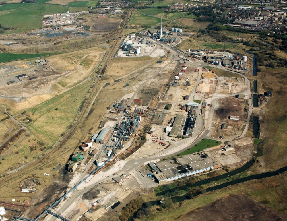
This is the full view from which the photo above is a detail. Photo courtesy Rhodia
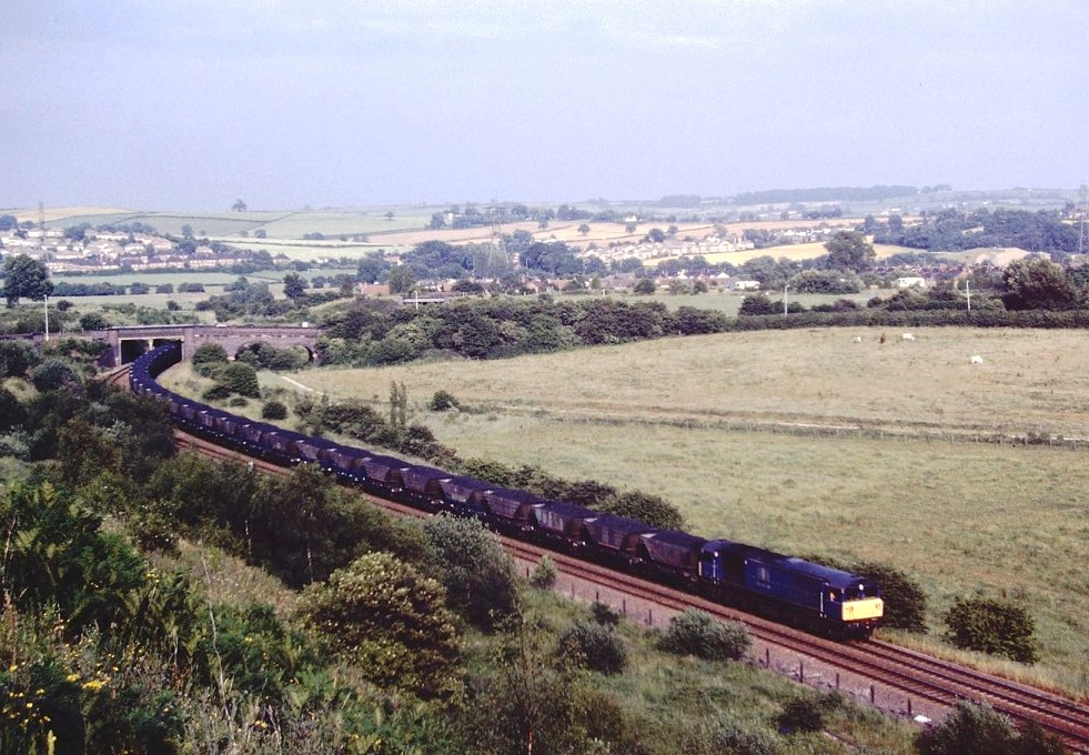
This shows Loco 58038 passing the basin site in July 1996. Photo by Stewart Donohoe
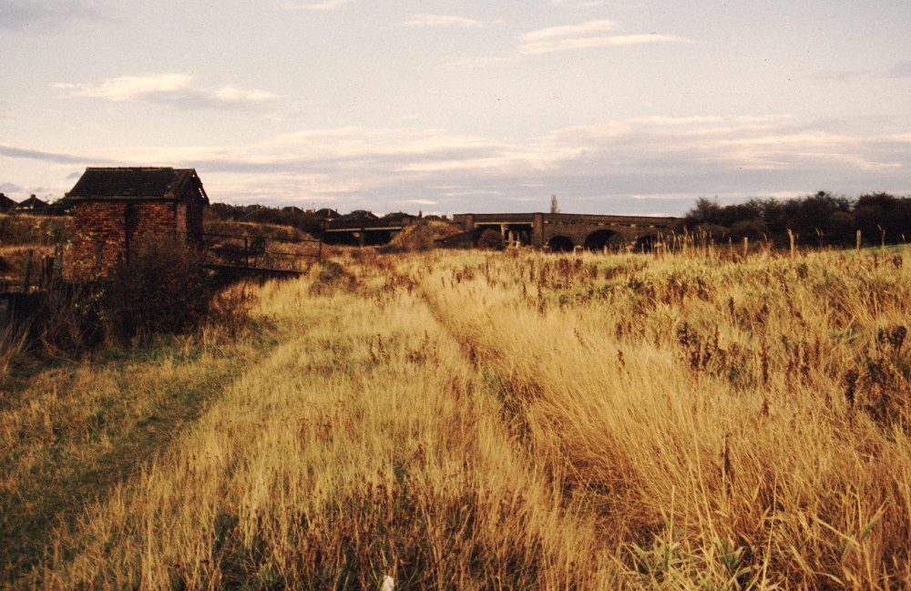
This shows the reverse view of the first photo, taken in 1986. Photo © John Lower