

9th April 2020
In these days of Google Maps and Google Earth, looking at aerial views is commonplace, however sometimes slightly older views, or those of a particular event can prove fascinating.
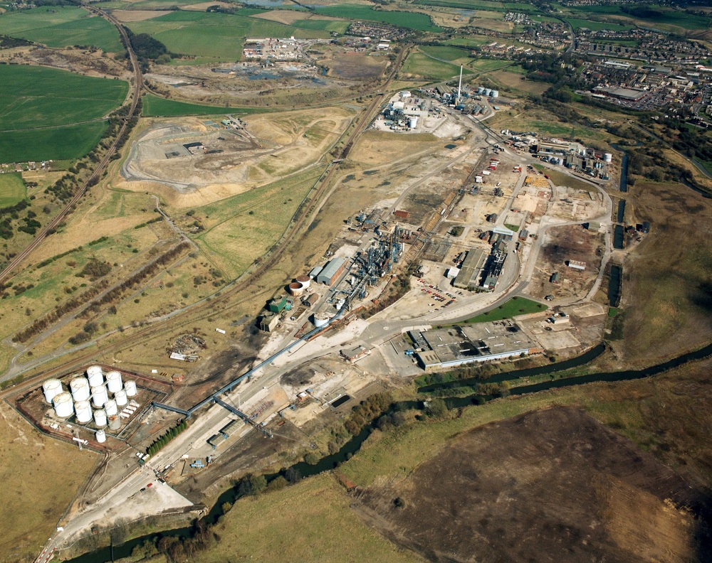
The first four photos of Staveley Chemical Works in the 1990s all came from Rhodia. This is looking east. The canal is top right, where you can see Mill Green and Morrisons. The watercourse in the foreground is the River Rother.
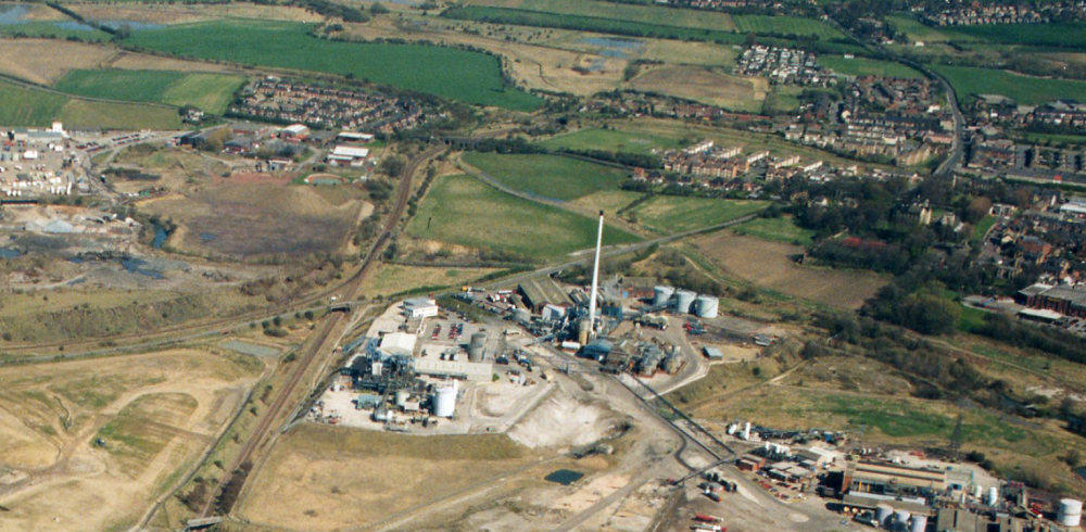
This is a close up of the above. The field to the left of the chimney is where Staveley Town Basin is now. As well as the basin, the Loop Road has now been built and the canal was moved south (uphill) so that Hall Lane did not need a hump backed bridge.
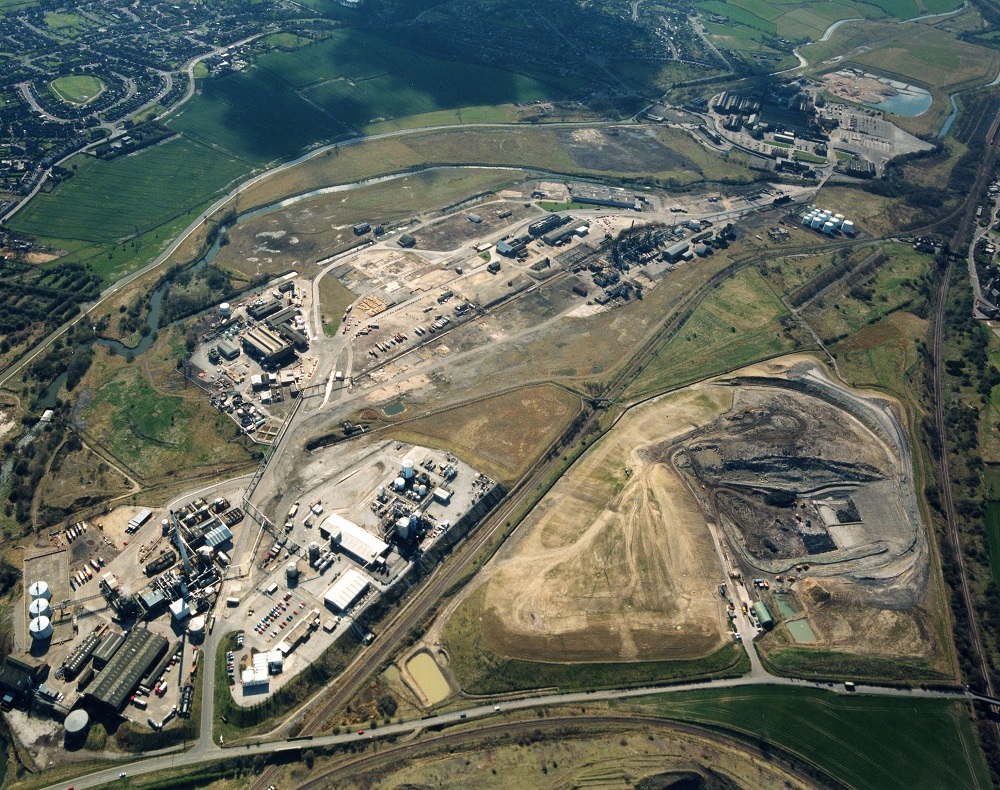
This is looking west. Hall Lane is at the bottom. The canal is the top stretch of water. The lower one is the River Rother.
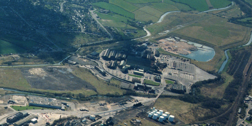
This is a close up of the above. The canal runs along the top and you can just see Works Road Bridge and Hollingwood Lock House centre left.

This view of Staveley Town Basin was taken by Don Cambridge from a light aircraft in September 2013.
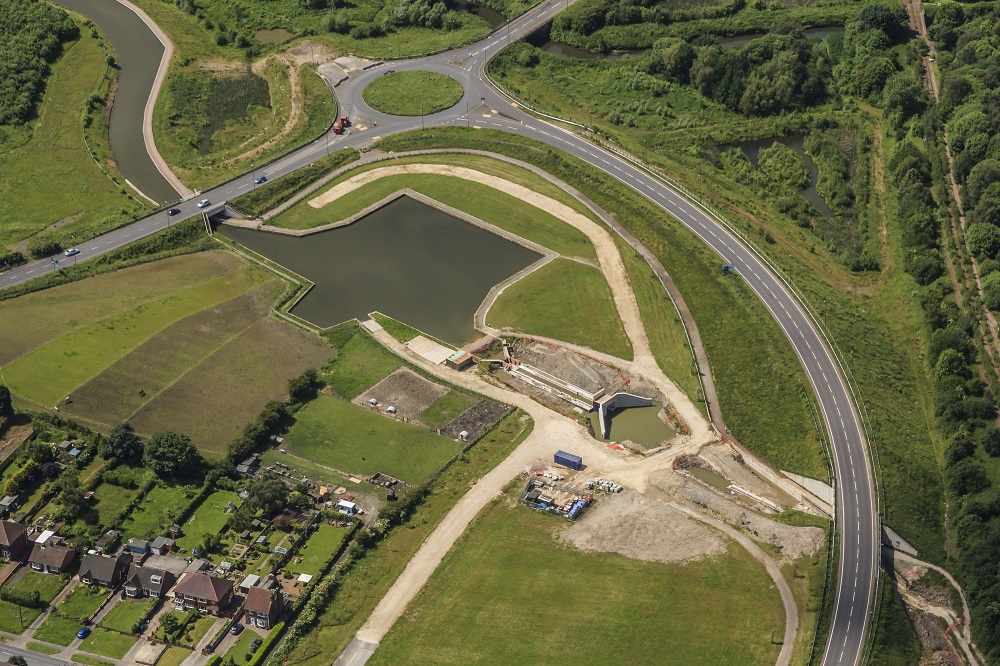
This one was taken by Richard Bird in June 2014.

This shot of Staveley Town Lock was taken by Mike Patterson from his multicopter on the Thursday before our 2014 Festival.
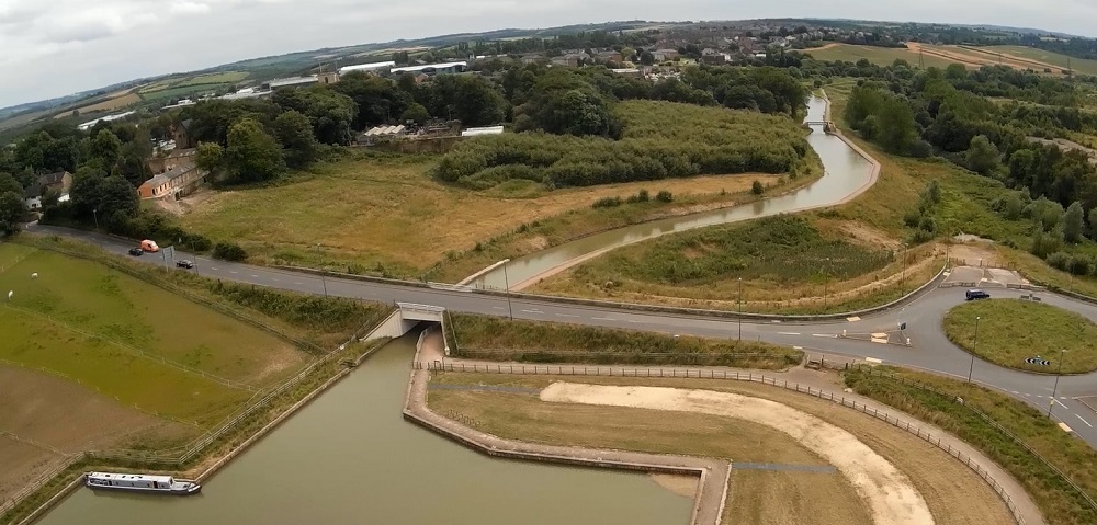
This is looking west towards Chesterfield. Note Constitution Hill footbridge in the distance which would be officially opened two days later.
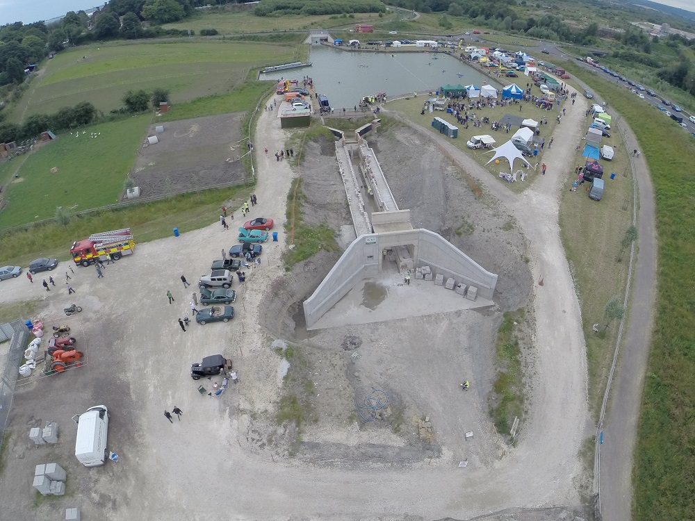
This was taken by Rise Above It at the Festival.

Mike Patterson took this photo of Staveley Town Lock on the Thursday before our Festival in 2018.
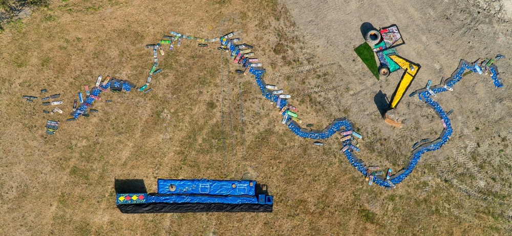
This piece of land art shows a map of the canal done by Donna Booth and Natalie Peace from the Chesterfield Cultural Education Partnership at our 2018 Festival. The locks are marked with skateboards as is the unrestored section. Denis the Digger has a real bucket and tyres. The boat is a representation of Madeline.
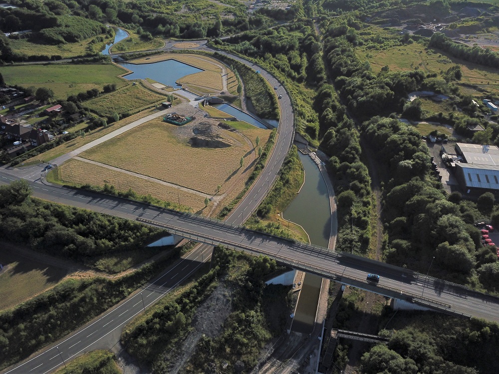
Mike Patterson took this often used image in June 2018. It shows Eckington Road Bridge and Hartington Harbour in the foreground, leading back to Staveley Town Lock and Staveley Town Basin. Apart from the basin and the lock wing walls, all the rest of the work was done by volunteers.

Mike took this shot of Dixon’s Lock …..

….. and this one of Bluebank Lock that now adorns the cover of our 2027 Appeal leaflet.

Going back in time, this is a photo of the canal in Killamarsh, probably from the late 1950s. In the background is Killamarsh Central Station on the Great Central Railway which is now the Trans-Pennine Trail. In the foreground is the Lancashire, Derbyshire & East Coast Railway. Spooner Drive is now in the field at the bottom right and Bryony Close in the one at the bottom left..

We got this shot of Drakeholes in the 1930s from Philip Ellis.The western end of the tunnel is on the bottom left, and you can see the canal emerging at the top centre and running off to the right.
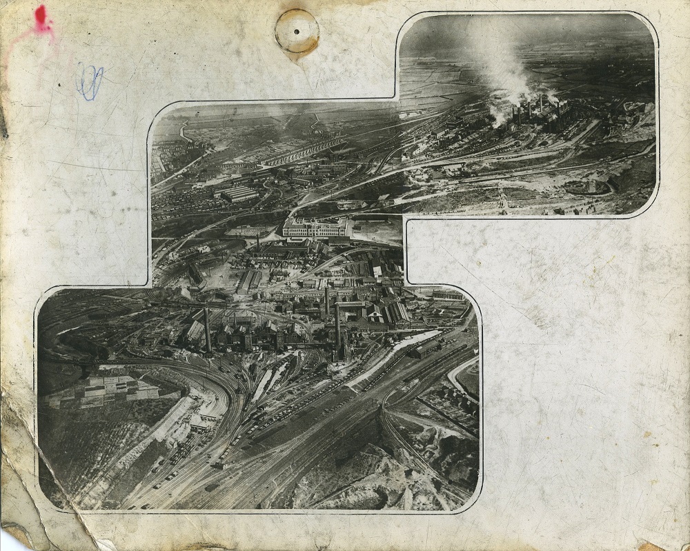
We got this 1927 photo of Staveley Works from Barrow Hill Roundhouse. The canal is at the bottom right. Note that a railway line crosses it roughly where the pipe bridge is now located.

Barrow Hill Roundhouse also gave us this 1933 photo. It shows Staveley Works with the Roundhouse at the top. The canal runs along the bottom, with Hollingwood Lock House on the right.
You can see an enormous number of old aerial images by logging onto Britain from Above.This is from a series of 83 photos from 1933, 1938 and 1946 of Staveley.
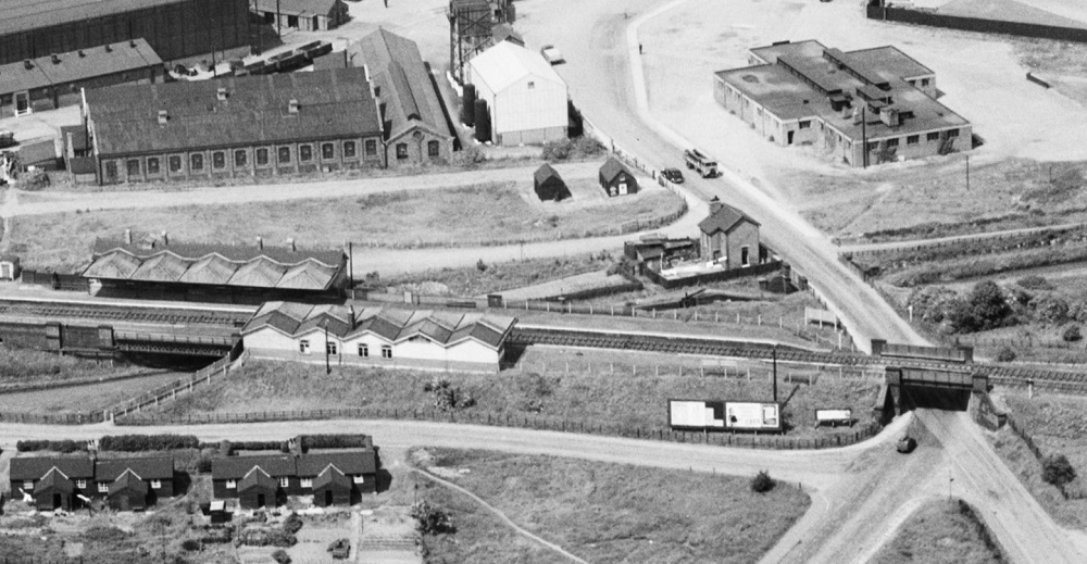
If you register on the site, you can zoom into photos and add information. This is Hollingwood Lock House (now Hollingwood Hub) with Staveley Works Station straddling the canal.
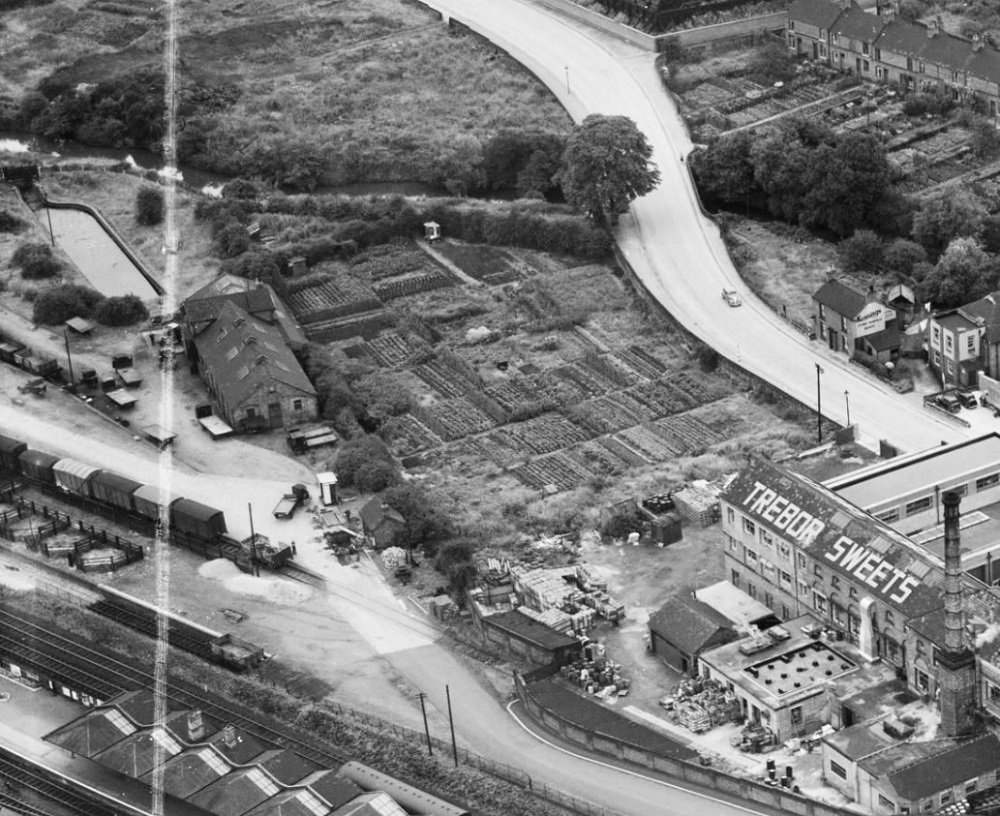
This is from a series of 1950 photos of Chesterfield. Note the canal’s second terminal basin on the top left.

This is from a series in Worksop in 1946. It shows Stret (foreground) and Deep Locks with the Lady Lee Arm bottom left. The Lock Keeper pub is now on the left of the canal between the locks. Sandy Lane, now crosses the canal just below Stret Lock.